
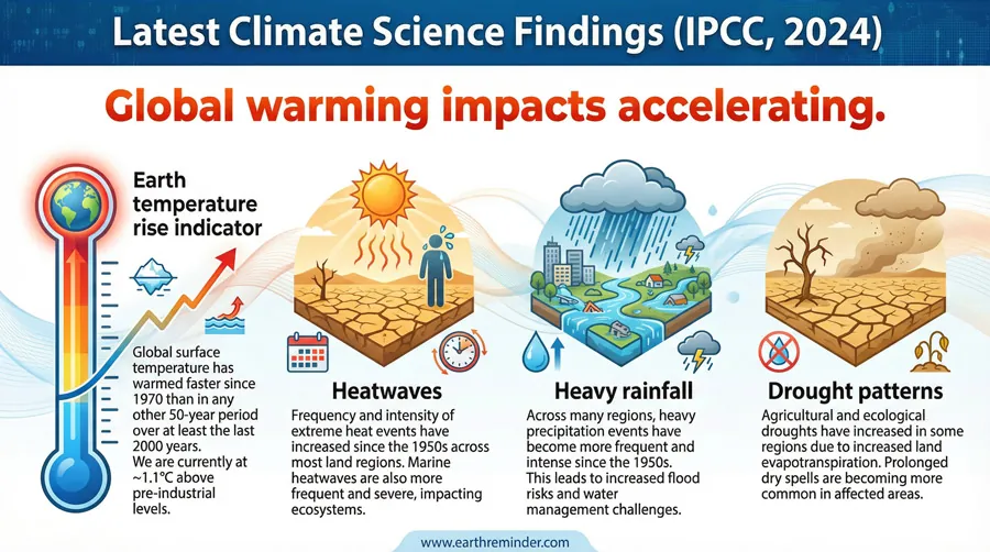
Rising air temperatures and unstable weather patterns increase atmospheric moisture, which leads to heavy rainfall and its consequences for local landscapes and infrastructure.
Why heavy rainfall occurs
| Cause | How common | How to confirm it | Fix it yourself? |
|---|---|---|---|
| Atmospheric moisture | Very common | Check humidity levels | No |
| Tropical cyclones | Common | Monitor weather alerts | No |
| Stationary fronts | Regular | Observe cloud patterns | No |
| Topographic lifting | Seasonal | Analyze map elevation | No |
| Urban heat islands | Localized | Measure city heat | No |
| Climate warming | Increasing | Review climate data | No |
The role of atmospheric water vapor
High levels of moisture in the air are the main driver of heavy rain events. Warm air behaves like a sponge, absorbing water vapor from oceans and lakes. As this air rises, it expands and cools, forcing the vapor to condense into droplets. This creates dense clouds that eventually release water faster than the ground can absorb it.
You can confirm high humidity levels by checking local meteorological reports or using a home hygrometer. When the air temperature sits near the dew point, the atmosphere is primed for heavy rain. If you notice a sudden drop in barometric pressure, it often signals that a significant storm system is moving into your area.
The intensity of the rain depends on how much water the air mass carries. In tropical regions, high evaporation rates mean rainfall can exceed 10 inches in a single day during peak seasons. If you live in a valley or a low-lying zone, you’re at a higher risk of water pooling during these events. For specific flood risk data in your region, consult the National Weather Service flood safety guidelines.
Impact of tropical weather systems

Cyclones and hurricanes bring massive amounts of rain that overwhelm drainage systems. Unlike standard thunderstorms, these systems move slowly, dumping rain on the same location for several hours or even days. This lingering effect is what transforms a simple rain event into a major flood disaster.
You can distinguish this cause from others by the duration of the rainfall and the associated wind speeds. If the rain persists for over 24 hours with steady, heavy intensity, a large-scale weather system is likely the cause. Smaller storms usually pass within an hour or two, whereas these systems dominate the entire regional weather pattern.
If you’re located near a coastline, the risk increases because these systems also bring storm surges. The combination of falling rain and rising sea levels prevents water from draining into the ocean. This creates a bottleneck effect where water levels rise rapidly in rivers and streets. If you observe water levels rising despite the rain slowing down, the system is likely pushing water back into your local watershed.
Topographic effects on rainfall
Mountains and hills force air upward, which causes it to cool rapidly and drop its moisture. This phenomenon, known as orographic lift, creates heavy rain on the windward side of mountain ranges. People living near these slopes often experience much higher annual rainfall totals than those in nearby flat plains.
You can confirm this by comparing your local weather patterns with nearby regions at different elevations. If your area consistently records higher rainfall than the surrounding lowlands during the same storm, the local terrain is likely influencing the outcome. This effect is most pronounced when wind blows directly against the face of the mountain range.
This isn’t for people who ignore local flood warnings, as mountain runoff can reach high speeds very quickly. If you live in a mountainous area, you must maintain clear drainage paths around your property to prevent debris from blocking water flow. A mistake many people make is assuming that being on a slope protects them from flooding, but this actually puts you in the direct path of fast-moving runoff.
Rare drivers of intense rain
Atmospheric rivers function like airborne corridors, often spanning thousands of miles. When these plumes strike coastal topography, they dump up to 15 inches of rain in under 48 hours. If the vapor transport remains perpendicular to the mountain range, expect catastrophic flooding.
Stationary fronts become dangerous when they align parallel to the prevailing upper-level winds. This alignment traps the storm system in place, causing it to “train” over the same location for days. If the rainfall rate exceeds two inches per hour, local drainage systems will fail within six hours.
Urban heat islands act as thermal anchors. These concrete zones force air to rise rapidly, cooling and condensing into heavy rain directly over city centers.
Convective instability creates the most localized threats. When the lapse rate exceeds 9 degrees Celsius per kilometer, the atmosphere becomes volatile. Watch for towering, cauliflower-shaped clouds; they signal an imminent, violent downpour.
Managing the risks of heavy rain
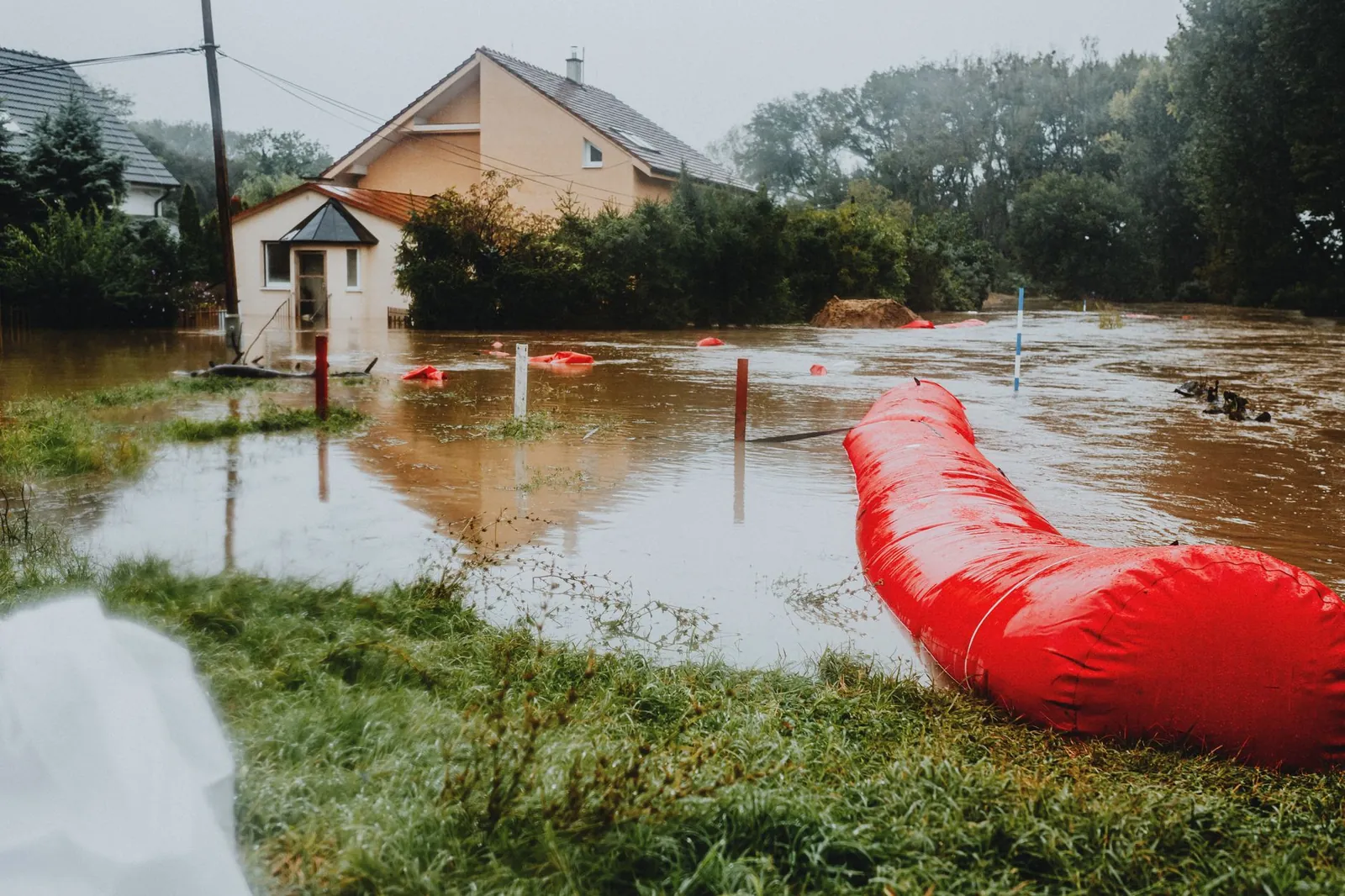
Fixing the consequences of heavy rain usually requires professional help, especially when dealing with structural water damage or soil instability. Homeowners should focus on preventative maintenance, such as cleaning gutters and installing sump pumps, which are relatively inexpensive compared to the cost of repairing water-damaged foundations. The complexity of these fixes depends on your property’s grade and the state of your local drainage infrastructure.
If your land is prone to erosion, you might need to consult a landscape engineer to install retaining walls or specialized drainage pipes. These projects can be costly and often require permits from local authorities. Always check your property’s elevation and flood zone status through official government records before planning major landscape changes. Relying on professional assessments ensures that your fix addresses the root cause rather than just the symptoms.
Related guides
- Best Camping Cots for Heavy People in 2026
- Best Camping Tent for Heavy Person in 2026
- Best Sleeping Bag for Heavy Person in 2026
Frequently Asked Questions
How much rain is considered heavy?
Heavy rain is generally defined as precipitation falling at a rate of 0.3 inches per hour or more. This specific threshold is used by meteorologists to identify when water will begin to accumulate faster than standard drainage systems can move it away from streets and buildings.
Does it matter if the ground is already wet?
Yes, it matters significantly because saturated soil can’t absorb more water. When the ground is already wet from previous rain, almost 100% of new rainfall becomes runoff. This leads to flash flooding much faster than if the ground were dry and capable of soaking up the initial downpour.
Is it safe to drive during heavy rain?
It isn’t safe to drive when visibility drops below 100 feet or when water covers the road. Hydroplaning occurs when your tires lose contact with the road surface, which can happen at speeds as low as 35 miles per hour if the water depth exceeds the tread of your tires.
How long does a flash flood last?
Flash floods typically last for 6 to 12 hours after the heavy rain ends. The exact duration is determined by the size of the watershed and how quickly the water can drain into larger rivers or the ocean. Check your local flood gauges to see how long water remains high.
What happens if my basement floods?
Your basement will likely experience structural damage and mold growth if water isn’t removed within 24 to 48 hours. The most important step is to turn off electricity to the area before entering, then contact a water damage restoration specialist to safely extract the water and dry the materials.
Can I prevent flood damage to my home?
You can reduce damage by installing backflow valves on your plumbing and ensuring your lot is graded away from your foundation. These steps rely on the specific slope of your land, so verify your property’s drainage plan with your local building department before starting any major construction or landscaping work.
Conclusion
Effective management of heavy rainfall starts with understanding your specific flood risk and maintaining your home’s drainage systems. While you can’t stop the weather, preparing for these events ensures that your property remains protected when the next storm arrives. Always follow official guidance from local authorities during severe weather to keep yourself and your community safe.
